1. Spatial IQ ai artificial intelligence branding design graphic design icon iconic logo map vector
    View Spatial IQ
    Spatial IQ
    0
    639
  2. Composite Map of Downtown Seattle cartography design gis illustrated map illustration map mapping
    View Composite Map of Downtown Seattle
    Composite Map of Downtown Seattle
    2
    710
  3. FLEXGIS: YOUR OWN INTERACTIVE MAP analytic data viz geography gis illustration interactive map maps
    View FLEXGIS: YOUR OWN INTERACTIVE MAP
    FLEXGIS: YOUR OWN INTERACTIVE MAP
    2
    1.8k
  4. Peermesh 2d 3d charts data gis information maps ui users ux
    View Peermesh
    Peermesh
    11
    2.4k
  5. City night blue building city cloud electric power illustration moon mountain night web wind
    View City night
    City night
    45
    9.2k
  6. Daily Earth Data Onboard, Card, Mapping & GIS gis vector web
    View Daily Earth Data Onboard, Card, Mapping & GIS
    Daily Earth Data Onboard, Card, Mapping & GIS
    13
    3.9k
  7. Food Delivery IOS App app branding delivery design eat food food delivery geo information projects gis graphic design ios map mobile red typography ui ux web
    View Food Delivery IOS App
    Food Delivery IOS App
    22
    713
  8. "Geospatial Services" illustration flat geolocation graphic design illustration map satellite vector
    View "Geospatial Services" illustration
    "Geospatial Services" illustration
    23
    3.2k
  9. Projecting the Impact of Rising Seas on U.S. Cities cartography design gis illustration map mapping
    View Projecting the Impact of Rising Seas on U.S. Cities
    Projecting the Impact of Rising Seas on U.S. Cities
    1
    363
  10. Data Visualization data visualization design digital design experiential design graphic design
    View Data Visualization
    Data Visualization
    0
    65
  11. Website for GISCARTA No-Code Constructor animation app branding dark design gis graphic design green illustration it logo maps motion graphics no code ui ux website
    View Website for GISCARTA No-Code Constructor
    Website for GISCARTA No-Code Constructor
    38
    1.1k
  12. GIS Illustration editorial geographic gis illustration infographic longform map maps
    View GIS Illustration
    GIS Illustration
    22
    3.2k
  13. 24px Icons 24px airport gis gui icons iconset maps metaphor minimal square symbol ui web
    View 24px Icons
    24px Icons
    52
    19.6k
  14. Remote Sensing/GIS Website branding design farm management gis green illustration remote sensing satellite soft ui ui ux
    View Remote Sensing/GIS Website
    Remote Sensing/GIS Website
    15
    2.7k
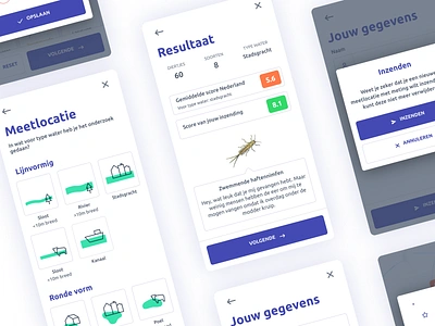
  15. Waterdiertjes.nl - UI design appdesign coding datadesign figma gis icon icondesign iconography insect interactive mapviewer sketch ui ux kit water waterdiertjes.nl
    View Waterdiertjes.nl - UI design
    Waterdiertjes.nl - UI design
    100
    10.6k
  16. GIS People Presentation ai dark theme deck design geospatial gis google slides graphic design iconography icons keynote ml nlp pitch deck powerpoint presentation tech technology
    View GIS People Presentation
    GIS People Presentation
    3
    1.6k
  17. The GIS tool set icon data development flat iconset it.internet light line user web
    View The GIS tool set icon
    The GIS tool set icon
    14
    1.8k
  18. Waterdiertjes.nl - UI/X design branding citizen science crowd data design figma gis icon icon design illustration illustrator interactive map mapviewer open data responsive responsive design typography vector webapp
    View Waterdiertjes.nl - UI/X design
    Waterdiertjes.nl - UI/X design
    6
    1.3k
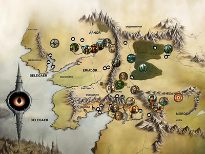
  19. Middle-earth Map Created with Midjourney 🌍 🗺️ 2d ai analytic branding dataviz design fantasy art generative art geography gis graphic design illustration interactive map map design maps middle earth midjourney ui
    View Middle-earth Map Created with Midjourney 🌍 🗺️
    Middle-earth Map Created with Midjourney 🌍 🗺️
    14
    1.1k
  20. LA | Thornton Watershed Map + Diagram analysis cad design diagram gis illustrator landscape architecture map protection research salmon seattle watershed wildlife
    View LA | Thornton Watershed Map + Diagram
    LA | Thornton Watershed Map + Diagram
    6
    1.3k
  21. Icons for GIS Interface data gis icons maps ui user experience vector visualization
    1
    View Icons for GIS Interface
    Icons for GIS Interface
    24
    3.1k
  22. GIS Map Illustration blue branding city design detail geography gis graphic design illustraor illustration information location location based service map minimal natural satellite vector
    View GIS Map Illustration
    GIS Map Illustration
    44
    13.8k
  23. GIS Web App screens button dashboard geo gis icon interface login map menu statistic ui ux
    View GIS Web App screens
    GIS Web App screens
    40
    5.4k
  24. Map Point Analyser Logo app branding data geospatial gis icon identity logo magnifying glass map map pin mapping
    View Map Point Analyser Logo
    Map Point Analyser Logo
    19
    5k
Loading more…