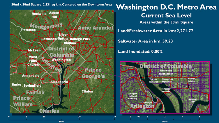
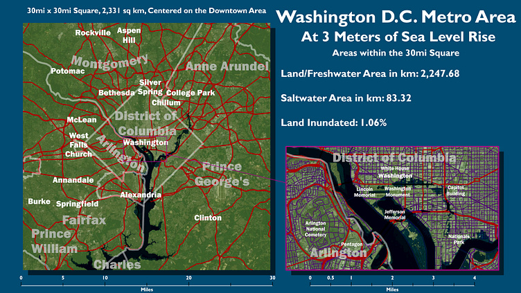
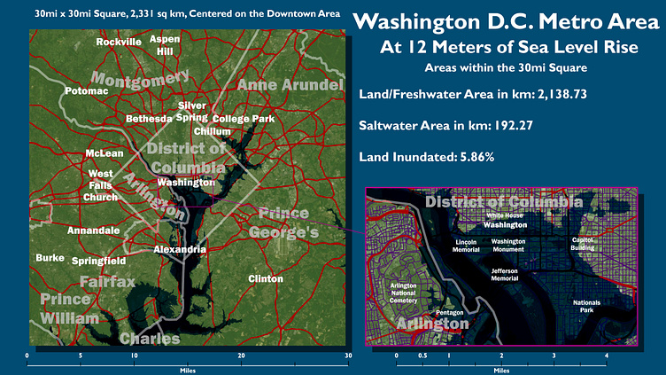
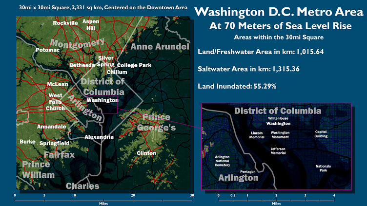
Projecting the Impact of Rising Seas on U.S. Cities
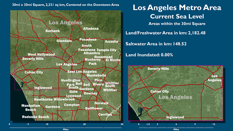
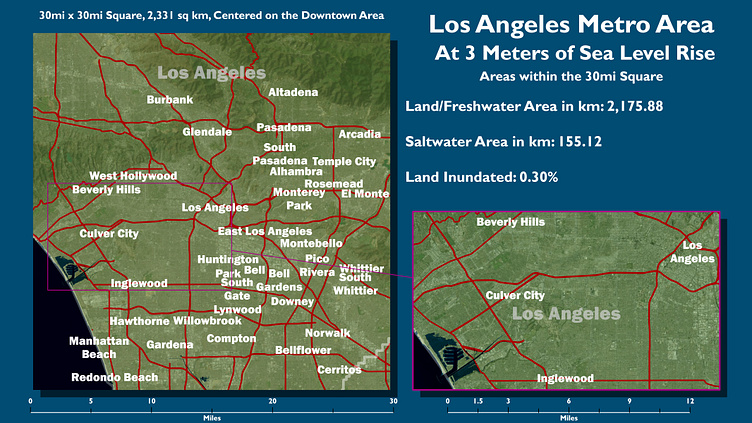
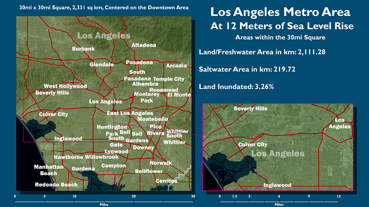
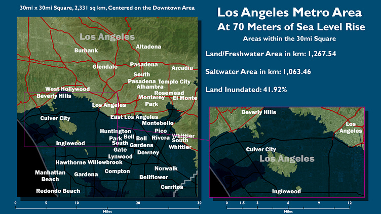
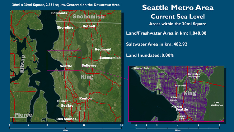
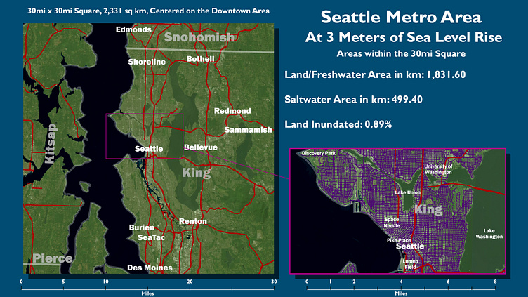
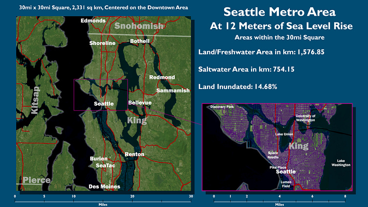
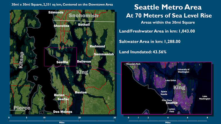
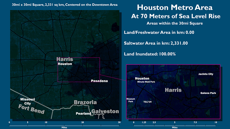
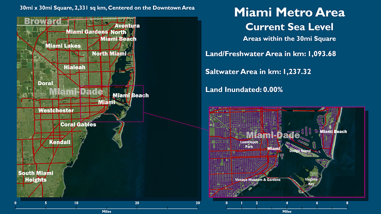
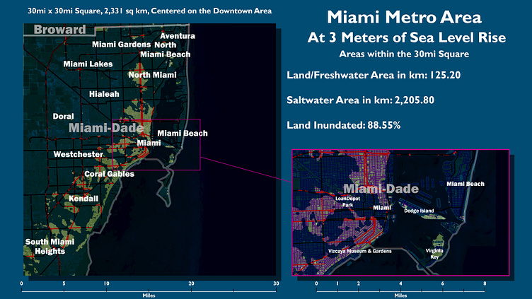
This was my Final Project in my Project Management and Remote Sensing/Image Analysis classes. I produced figures exploring three different sea level rise projections, 3m, 12m, and 70m, for the D.C., LA, Seattle, Houston, and Miami metro areas, for both the project and an ArcGIS Online StoryMaps article.
https://storymaps.arcgis.com/stories/60e32831e6f845cdbdc61e2b517bcb06