1. Gis Mapping Technology Solutions city cityscape google illustration location map phone pin search tablet technology travel
    1
    View Gis Mapping Technology Solutions
    Gis Mapping Technology Solutions
    140
    29k
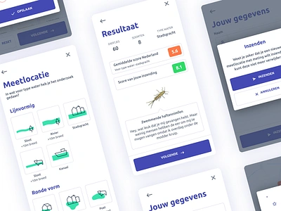
  2. Waterdiertjes.nl - UI design appdesign coding datadesign figma gis icon icondesign iconography insect interactive mapviewer sketch ui ux kit water waterdiertjes.nl
    View Waterdiertjes.nl - UI design
    Waterdiertjes.nl - UI design
    100
    10.6k
  3. SE Server data gis illustration server work
    View SE Server
    SE Server
    26
    4.8k
  4. GIS is Everywhere Poster Illustration explore forest geography gis illustration man parks people science vector
    View GIS is Everywhere Poster Illustration
    GIS is Everywhere Poster Illustration
    62
    14.4k
  5. Measuring proximities. architecture gis graphics gsd illustration mapping surface
    View Measuring proximities.
    Measuring proximities.
    17
    2.8k
  6. Consumption//Production architecture gis graphics gsd illustration mapping surface
    View Consumption//Production
    Consumption//Production
    18
    2.7k
  7. Water Cubes data visualization gis illustration infographic map water
    View Water Cubes
    Water Cubes
    17
    2.8k
  8. Boundless sticker american design gis illustration location map united states usa
    View Boundless sticker
    Boundless sticker
    26
    7.1k
  9. earth-62 3d data geo gis illustration map poster
    View earth-62
    earth-62
    11
    2.8k
  10. WebGIS Publisher - GIS Viewer - UI/X appdesign coding gis iconography mapviewer sketch tool ui uix
    View WebGIS Publisher - GIS Viewer - UI/X
    WebGIS Publisher - GIS Viewer - UI/X
    47
    6.2k
  11. København Artistic Map city color colorful copenhagen flat geographic geography gis illustration map mapping poster posters qgis urban planning vector
    View København Artistic Map
    København Artistic Map
    31
    10.8k
  12. The Editor data editor gis illustration information map woman working
    View The Editor
    The Editor
    19
    4.3k
  13. The Professional creating creative gis illustration maps woman working working process
    View The Professional
    The Professional
    33
    5k
  14. GIS System analysis design gis isometric space ui vector
    View GIS System
    GIS System
    23
    3.5k
  15. The Creator creation creative data design gis illustration information man map people
    View The Creator
    The Creator
    24
    4.6k
  16. Slow-Fast, High-Low art direction gis graphics gsd illustration illustrator mapping photoshop surface urbanism
    View Slow-Fast, High-Low
    Slow-Fast, High-Low
    17
    2.3k
  17. Rulers for GIS Project icons rulers simple
    View Rulers for GIS Project
    Rulers for GIS Project
    21
    1.5k
  18. WebGIS Publisher - GIS Viewer - UI/X appdesign coding gis iconography mapstyle mapviewer sketch ui uix
    View WebGIS Publisher - GIS Viewer - UI/X
    WebGIS Publisher - GIS Viewer - UI/X
    22
    3.7k
  19. GIS Map Consulting Icon Set analytics business consulting gis globe icon map thinking
    View GIS Map Consulting Icon Set
    GIS Map Consulting Icon Set
    15
    2k
  20. Waterdiertjes.nl - UI design appdesign citizen science coding data figma gis icon icondesign iconography insect interactive sketch tool ui uix water waterdiertjes.nl
    View Waterdiertjes.nl - UI design
    Waterdiertjes.nl - UI design
    15
    2.5k
  21. BDLISA 3d gis icons reponsive water web website
    View BDLISA
    BDLISA
    15
    2k
  22. Peermesh 2d 3d charts data gis information maps ui users ux
    View Peermesh
    Peermesh
    11
    2.4k
  23. The GIS tool set icon data development flat iconset it.internet light line user web
    View The GIS tool set icon
    The GIS tool set icon
    14
    1.8k
  24. Meet Mariana abstract aerial art artwork bathymetry blockchain colors cryptoart ethereum geography gis map mariana trench nature nft opensea polygon scientific spatial spectrum
    View Meet Mariana
    Meet Mariana
    15
    4.2k
Loading more…