Backyard Building Envelopes
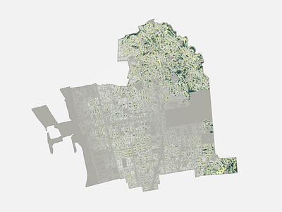

This was a study I did with QGIS to map how many backyard cottages could fit in Berkeley, California. I used zoning data to map single family residential zoned properties (gray), and then found minimum available space and dimensions within setbacks from property lines and existing buildings to show areas where a backyard home could be built (dark green). The yellow highlights properties with an eligible backyard.