Illustrated Norway map
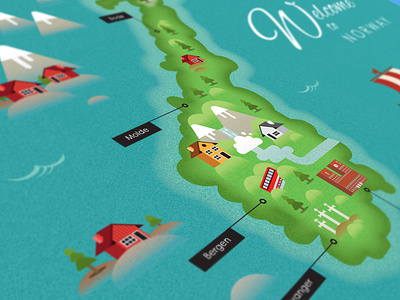
After a trip to Norway, I was overcome with the beautiful backdrops and Fjords and felt as though I had a connection to the place. So when I came back not long after, I decided I'd like to create something as a kind of souvenir and decided what could be better than to create an illustrated map of Norway.
I created all the assets myself and brought it all together to create an A3 landscape map that would be professionally printed and framed. The map uses a flat style illustration approach with subtle use of texture/gradients, I have also brought out key features such as the Fjords, houses and monuments which I feel make Norway unique.
I was pleased with the result and it has given me encouragement to create similar illustrated maps for other countries in the future.
