Electronic Range and Bearing Line (ERBL) tool
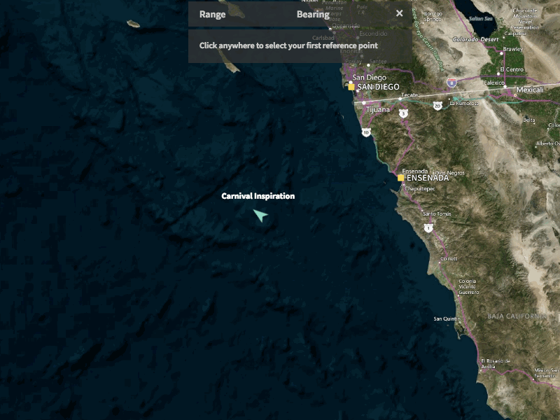
This ERBL tool is used for measuring the range (in nautical miles) and bearing (in degrees) between two points on the map. In this case the user is checking the range and bearing from the ship to port.
The use case could be to quickly find the nearest port in an emergency situation, or to see how close two ships are.
A fun design-dev collaboration :)
