St. John Lutheran Church & School 3-D map illustration
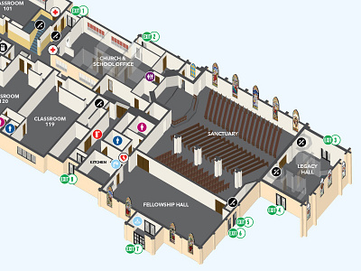
I created this 3-D illustration of the church and school as a wayfinding map to be placed in various spots throughout the building. I used scans of the original 2-D blueprints of the church as the reference, building a 2-D flat map first, then extending shapes upwards from there to create the 3-D effect. This was a very time intensive project but the end result was worth the effort.