Transit Map Concept for Lowell, MA
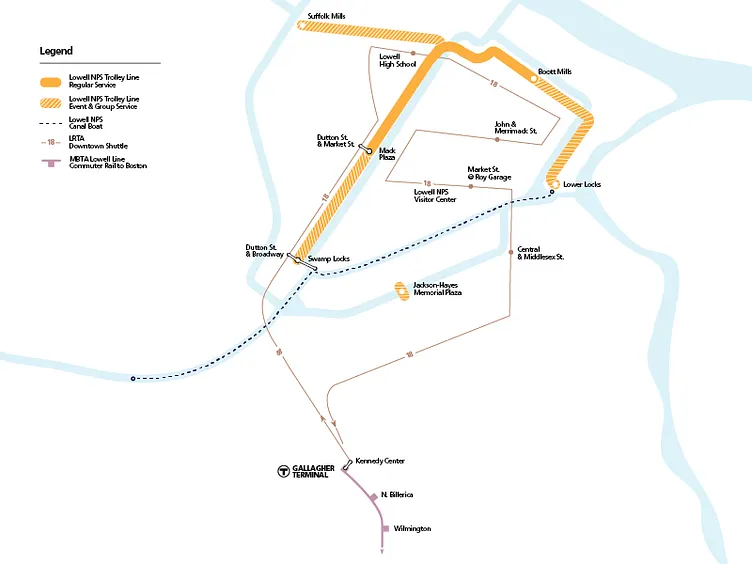
Concept for a MBTA-style transit map of Downtown Lowell. Meant to show connections in commuter rail, bus, trolley, and canal boat. Blue is for the Merrimack & Concord Rivers and the Lowell canal system that connects (or goes around) them.
