Pollution Visualization


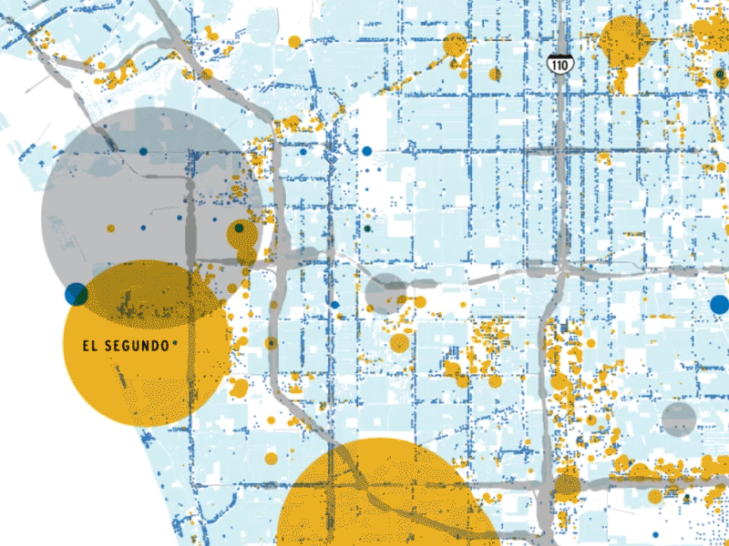
Residential, transportation, commercial and industrial CO2 emissions visualized across a slice of Los Angeles. I used ArcMap to wrangle data from the Hestia Project and Illustrator/Photoshop to polish it. I was inspired by the agency Clever Franke's visualization of pollution in Indianapolis, which also visualized Hestia Project data.
