Dribbble: the community for graphic design
Shots
Shots
Designers
Explore
Popular
New and Noteworthy
Product Design
Web Design
Animation
Branding
Illustration
Mobile
Typography
Print
Hire a Designer
Browse Designers
Submit a Project Brief
Post a Job
Hiring on Dribbble
Find Jobs
Blog
Sign up
Log in
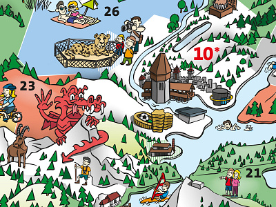
Illustrated Map
Stefan Wallimann
Follow
Following
Like
Get in touch
#3B4237
#FBFBFA
#D7E4E6
#A3CBEE
#7C8D6B
#EA856C
#96C992
#DAD5A2
Download color palette
illustrated map with fun sightseeing/travel hotspots, done for a public transportation organisation.
Stefan Wallimann
Get in touch
More by Stefan Wallimann
View profile
Previous
Next
Loading…