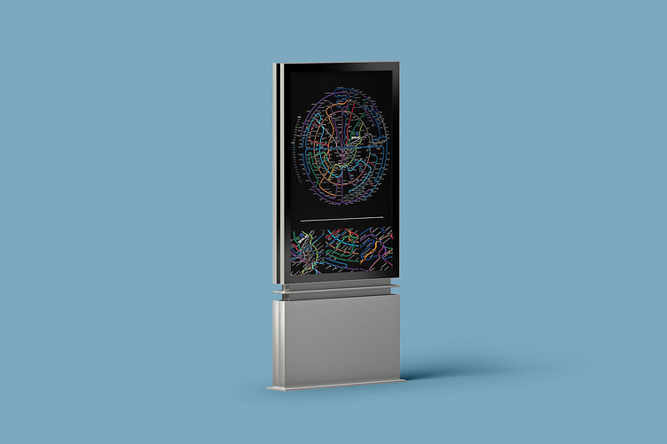
The Circular Transit Diagram Project
Looks over Intuition
The intuitive behaviour of opening a door is something commonly learnt and practiced by most people on this planet, and has a standard it follows: Twist, push or pull a lever, then push or pull (or slide) the door open. A door that functions differently will likely not stand the test of time and need signs to explain its interaction. The same is true for maps: We all agree on north being up, we almost exclusively use mercator projections and we use a scale which applies similarly to all axis.
The same is not true for diagrams. While the north is usually kept up, there is no need for scale, geographical accuracy or relation. This helps to shift the focus and create a better intuitive journey for users. When Harry Beck created a transit diagram for the London Tube in 1933, it was a new and revolutionary way to approach customer information and navigation. A change that needs education: Massimo Vignelli's 1972 transit diagram of the NYC subway was received badly by the public, missing critical geographical features to help with above-ground navigation. Eventually the MTA switched back to a more geographically accurate diagram. Issues that citizen of Berlin didn't face: The so-called 'ring' a circular s-bahn line surrounding the central districts of the city, makes for a landmark that serves as a geographic navigational feature since 1877. Berlin's maps and diagrams have therefore always emphasised on this circular aspect, taking the need for many geographical features to aid orientation.
This stands at the core of the project: A circular transit diagram of Berlin's S+U-bahn network. Bringing a complex system onto a compact canvas with high accuracy of network connectivity and clarity. The diagram aims to follow general geographic directions inside the circle and prioritises space saving over geography outside of it. Its use aim is solely informative and limited to the use of the network. It is a clear example of 'Looks over intuition' as it would not serve well in a real world environment. A hybrid version with circular and radial line arrangement could serve as an actual way-finding diagram for the network, though it would also need to include train lines and ferries to give a complete overview of all the intra-city transport modes. Similar concepts have already been done by other people, see here and here.
If you made it this far, thank you very much for reading and have a great day!


