Sentinel: Safeguarding Our Orbital Highways 🛰️🌍
Hello Dribbble community! 👋 Thrilled to showcase Sentinel, a cutting-edge platform designed to tackle the growing challenge of orbital debris management.
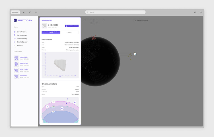
Sentinel transforms complex space data into an intuitive, actionable interface for space agencies and satellite operators. This sleek, information-rich design makes tracking and analyzing orbital debris a precise and efficient process.
✨ Key Features:
Interactive 3D Earth model for real-time debris visualization
Detailed debris tracking with size, mass, and material composition data
Orbital information display including altitude, inclination, and period
Risk assessment tools for potential collisions
Mission planning capabilities for debris mitigation strategies
Analytics for long-term space environment monitoring
🎨 Design Highlights:
Clean, minimalist UI allowing focus on critical data
Intuitive color coding for different types of space debris
Seamless integration of 2D data panels with 3D visualization
Responsive design adapting to various screen sizes for control centers
Clear information hierarchy for quick interpretation of complex data
The challenge was to create a tool that presents intricate orbital data in an accessible, actionable format. We aimed to design an interface that empowers space professionals to make informed decisions quickly, ultimately contributing to a safer and more sustainable orbital environment.
What are your thoughts on designing interfaces for space applications? How would you balance the complexity of orbital mechanics with user-friendly visualizations in such a critical domain? Always eager to hear your insights and experiences! 🚀💻


