AquaVista: Empowering Morocco's Water Management 💧🇲🇦
Salaam Dribbble community! 👋 Excited to share a glimpse into AquaVista, a powerful platform designed to revolutionize water monitoring in Morocco.
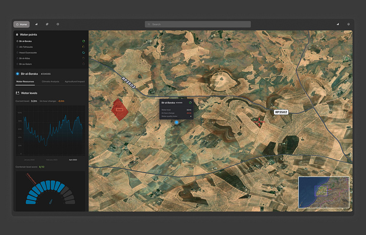
AquaVista transforms complex hydrological data into an intuitive, actionable interface for engineers and water management professionals. This sleek, information-rich design makes tracking and analyzing water resources across Morocco's diverse landscape a breeze.
✨ Key Features:
Interactive satellite map overlay for precise location tracking
Real-time water level monitoring with historical data visualization
Climate analysis and agricultural impact assessment tools
Multi-point comparison for regional water resource management
Customizable alerts for critical water level changes
Detailed water quality index scoring system
🎨 Design Highlights:
Dark mode interface reducing eye strain for long monitoring sessions
Intuitive color coding for water levels and quality indicators
Seamless integration of data visualization with geographical context
Responsive design adapting to various screen sizes and devices
Clear information hierarchy for quick data interpretation
The challenge was to create a tool that presents complex environmental data in an accessible, actionable format. We aimed to design an interface that empowers engineers to make informed decisions quickly, ultimately contributing to sustainable water management in Morocco.
What are your thoughts on designing interfaces for environmental monitoring? How would you balance data density with user-friendly visualizations in such critical applications? Always eager to hear your insights and experiences! 🌍💻
