Topographic France Puzzle
The follow-up to my USA puzzle, France was a very different experience!
Fewer pieces and smaller landmass meant that a 3D print of similar size could hold much more detail, evident in how the mountains and valleys appear.
With this map, and moving forward into the future maps I made, the question of how MUCH to exaggerate topographical detail became a question. on a piece by piece basis this wouldn't be much of a concern, but the whole map had to match. So to keep everything proportional I went with almost comically high mountains as this kept the valleys and rivers well formed.
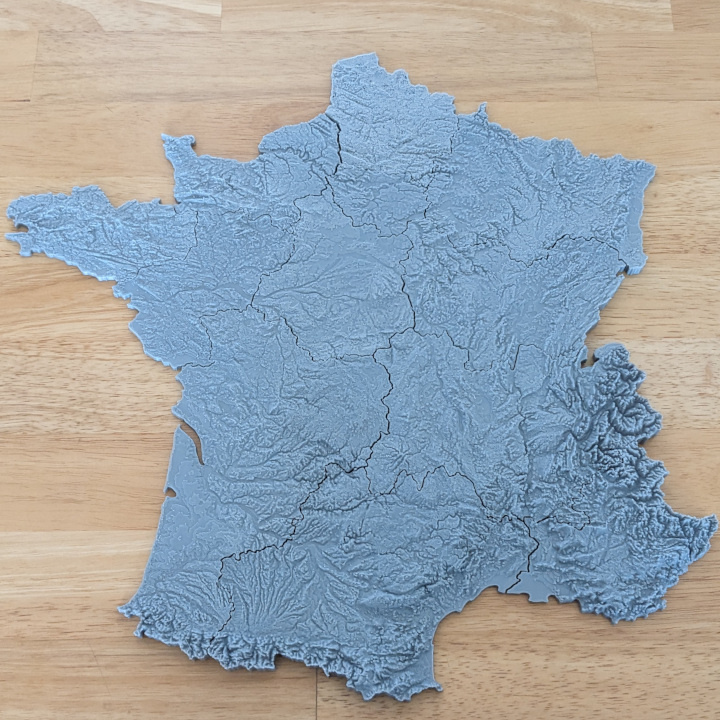
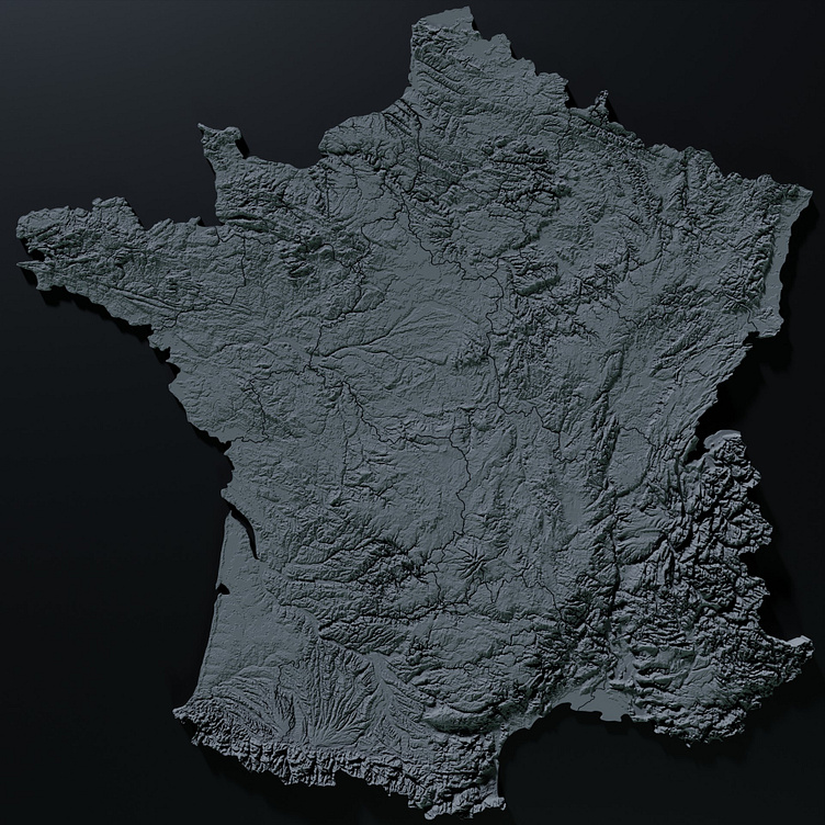
At this scale, as opposed to the USA map (shown in a previous post, though both maps are around the same 'height' top to bottom), FDM (photo above) is able to capture MUCH more of the detail in the dense STL files (rendered in Blender, below)
Files available on Cults3D for sale!
https://cults3d.com/en/3d-model/game/topopuzzle-3d-france-12-pieces
