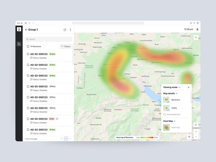
Visualising air traffic for drone management platform
Each receiver is able to detect air traffic within a limited distance. The further the aircraft from the receiver is, the weaker the signal. Our client wanted his users to clearly understand what their receivers' coverage is.
We chose to depict the area the cluster of receivers’ cover zones with the heatmap.
Get in touch to hire Eleken SaaS designers
Let us help you design, fix or scale your SaaS product!
More by eleken View profile
Like
