FitFusion Location Tracker App
Hello everyone,
I have completed task #UIX101 #020 😊
In this task, preliminary work was required for a mobile application initiative aimed at promoting outdoor sports.
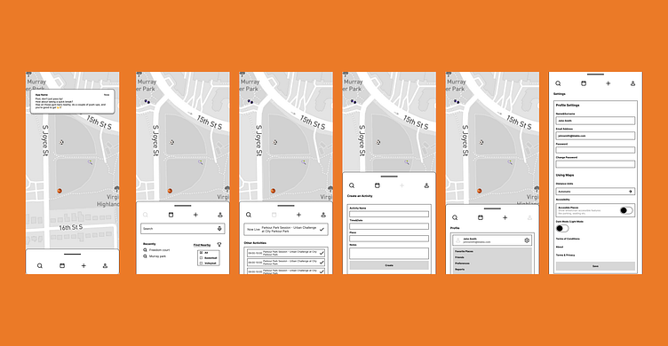
While working on the project, I prioritized the prominence of the map by using an expandable/collapsible menu, ensuring that the map remains visible on pages other than the settings.
I've started with wireframe. The main reason I started with wireframes was to clarify the basic structure and functionality of the project and to plan the user experience before moving on to visual design. Since I worked on this process alone, wireframes were extremely valuable to me both for organizing my thoughts and determining the overall appearance of the project. Wireframes show the general layout, navigation, and important features of the application in a simple manner, independent of detailed design and visual elements. This way, I can identify potential issues early on and quickly create prototypes. The main focus during the wireframe stage is to enhance the user experience and optimize the fundamental functionality of the application.
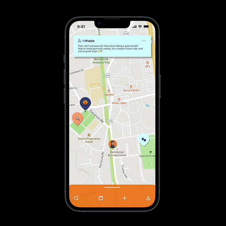
When the application is open and the user is walking by a nearby sports center, they will receive a notification saying "There's a sports facility nearby. Don't miss out, get some exercise!"
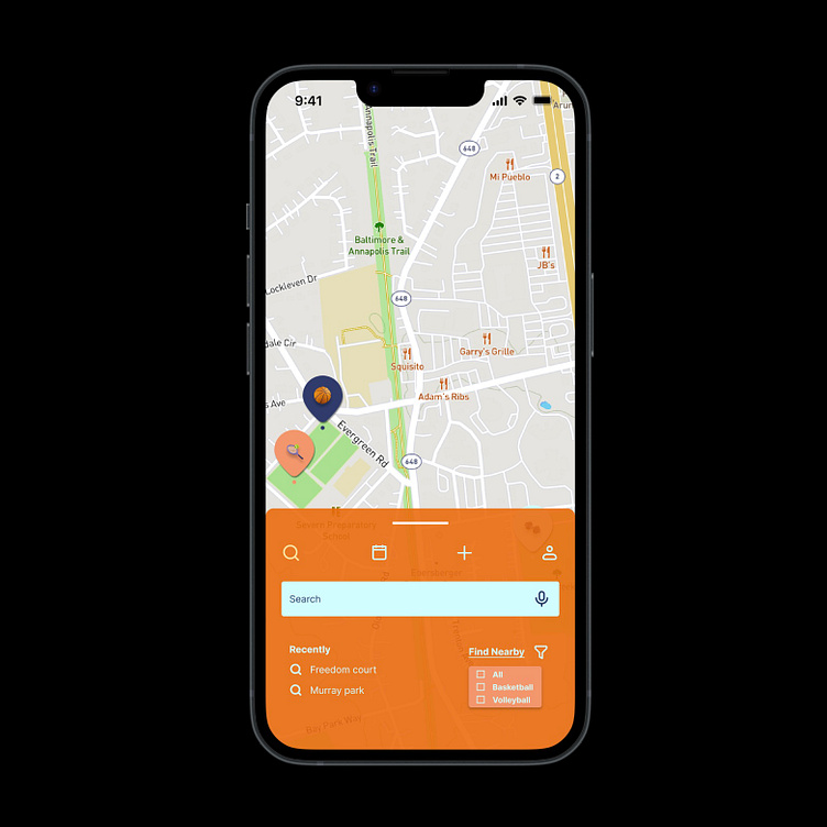
The user can see their recent searches in the search section and filter sports activities by type using the "search nearby" option.
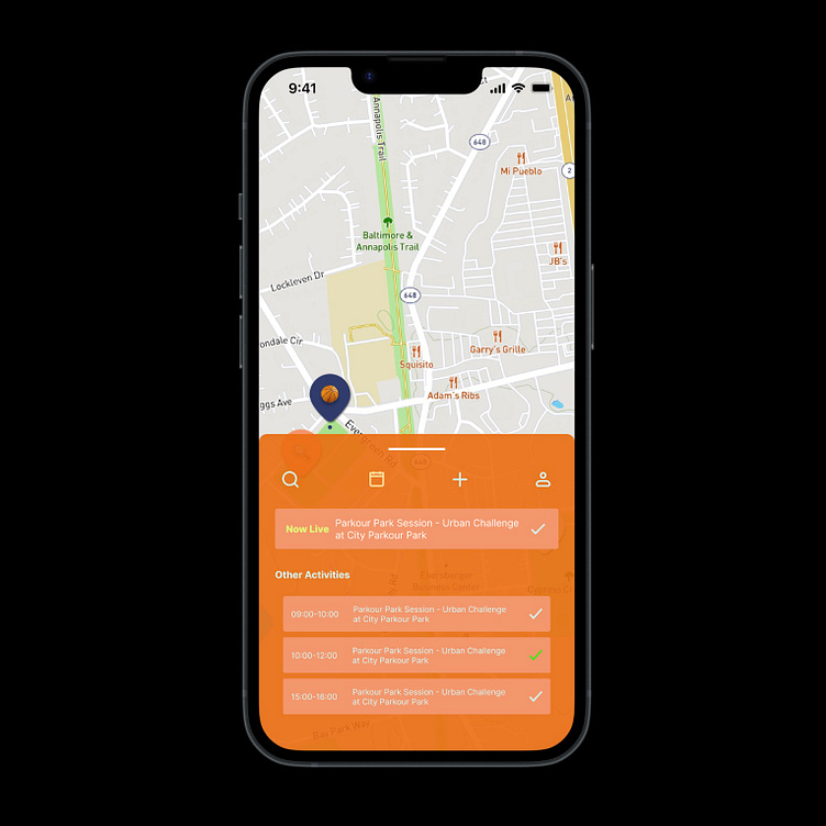
Our user can also indicate their participation in events created by other users and see real-time nearby events.
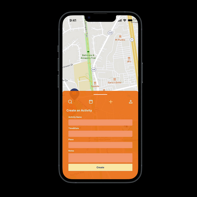
They can create their own event by simply entering the event name, time, location, and any additional details they want to add.
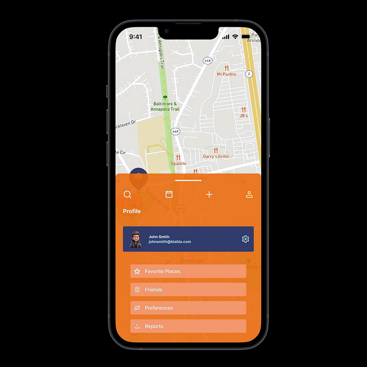
In the user profile section, they can view their favorite places, friends, usage preferences, and any notifications they've made (bug reports, complaints, etc.).
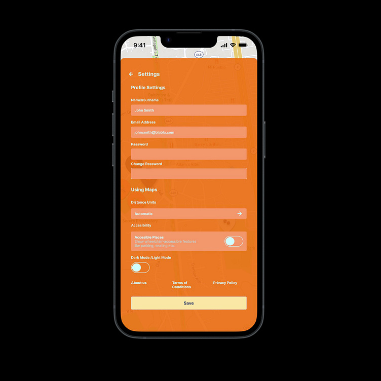
Finally, in the settings section, the user can view their username and password, change their password, and select their preferred unit of measurement, with the default unit being used if no selection is made.
For individuals concerned about accessing the event area for any reason, there is an accessibility toggle switch. When this switch is on, features like wheelchair accessibility, park areas, or seating areas will be displayed on the map.
Lastly, there is an additional toggle switch for switching between dark mode and light mode.
I also prepared a prototype to demonstrate transitions!
I tried to create an MVP project that encourages sports participation to the best of my ability.
I hope you like it 🚴🏻♀️
