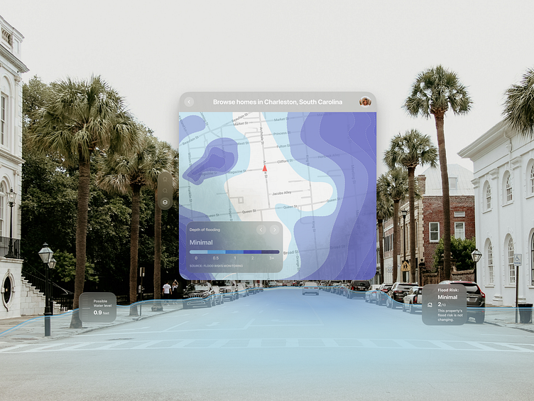
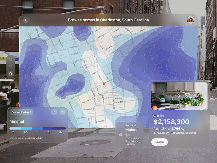
Depth of flooding heatmap layer.
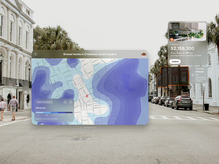
This quick concept showcases a spatial interface for a real estate platform, transforming on-site interactions with property information.
By integrating flood data into a dynamic map, it provides users with instant access to key property features and potential water levels, significantly simplifying the decision-making process for all participants in the real estate market. This functionality not only visualizes geographical features and associated risks but also facilitates easy access to a wide range of data and property characteristics, as well as other heatmap layers, making the application a valuable tool for real estate professionals.