Sea weather and underwater conditions with Sealoc
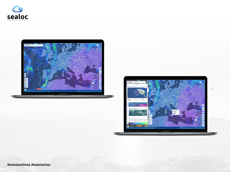
Sample of 2 desktop screens showing the complex map interactions of a location in a map on a desktop.
At a UI level on the right of both screens, you can see the available metrics, which are adaptable to the user's selection of sea depth level.
On the left side of the right screen analytical location details are shown
The map is dynamically animated with particles.