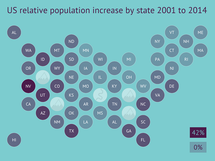
Choropleth using circles
So many data 'maps' of the US show real colorized geographical maps that make it awkward to scan due to the massively different sizes of states.
More often than not, the data does not need to be presented so literally in relation to size of state.
This choropleth shows data for each state independent of its size, whilst trying to maintain approximate relative location and nearest neighbors.
The equal spacing removes geographical clutter. Using circles allows for 6 neighbors (unlike squares) but is easy on the eye (unlike hexagons).
The major mountain/river 'voids' represent major geological features but serve a dual purpose of soaking up space and allow more logical positioning for neighboring states.
The data here shows an example use case, but is real data.
