3D Topo Infographic
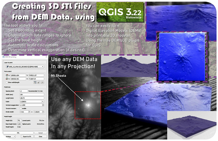
This is an Infographic I made for an assignment in my Remote Sensing/Image Analysis class. We were able to make the infographic about anything Remote Sensing related we wanted, so I decided to make mine about a plugin for QGIS that allows you to turn Digital Elevation Model data into exportable 3D .stl files, than can be used for modeling, 3D Printing, CNC work, and many other applications. I generated an example model of Mt Shasta that I refer back to consistently throughout the layout, and I was able to get that model actually printed from a Resin Printer, allowing for an incredible level of detail. I included shots of that print in the layout as well. Homework assignment, created 3/20/2023
