Campus Mapping Project
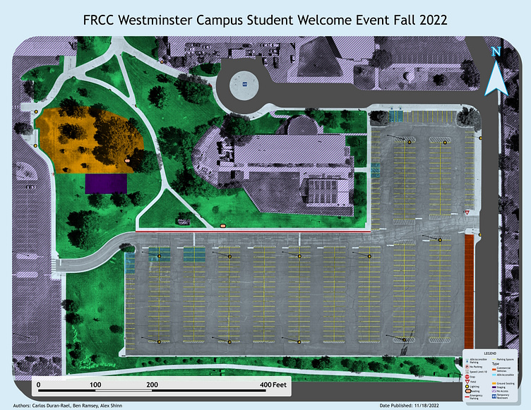
This is an event map for a fictional event at Front Range Community College, Westminster campus. This map was made by me and my team for our Geographic Positioning Systems class. The team of three went out and personally collected all data with GNSS Receivers, which includes all points, lines, and polygons. In the class, we also went over some drone imagery. Our team programmed some flight paths to go over the campus, and was able to generate a 10cm pixel orthomosaic image, which is used in the layout overlay. Data Collection, Data Dictionary, Flightpath, and Layout developed alongside my colleagues Alexander Shinn and Ben Ramsey. Made 11/18/2022
