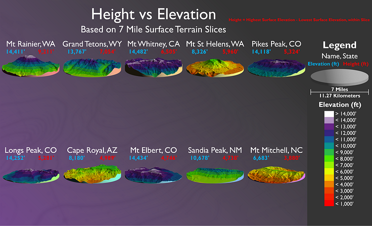
Height vs Elevation
This is the layout for my final project in my Raster GIS class. I came up with a way to determine mountain height using minimum surface elevation within a standardized buffer. I call them "Elevation Slices". This layout shows 10 features in the US, ranked by height based on 7 mile diameter slices. The coloring symbolizes elevation as opposed to height, with both values displayed above each slice. I've also included some slides from my presentation. Created 12/12/2022
More by Carlos Duran-Rael View profile
Like


