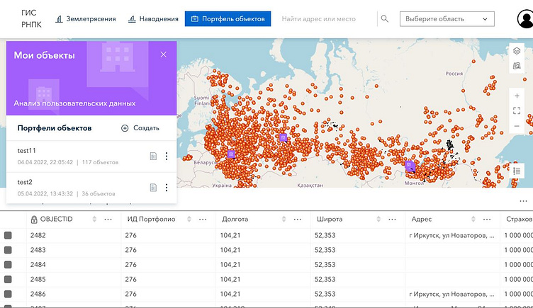
An interactive geoportal for catastrophic risk assessment
Since 2021 the Flexatel team has been at work on a major project—an interactive geoportal ment to serve as a nationwide information and analytical resource for catastrophic risk assessment of insured property. It will become a new digital channel facilitating interaction in the Russian insurance market.
The system is designed for comprehensive automation and analytical support of both the customer company and the Russian insurance and reinsurance market. These features are vital to risk assessment operations, facility vulnerability assessment, and emergency modeling through geographic spatial analysis.
The heart of the geoportal is a digital map of emergency risks, depicting different levels of exposure to earthquakes and flooding for a particular point or region of Russia. Users can also download data on their own facilities to obtain information on natural disaster risks.
Looking forward to your feedback!
