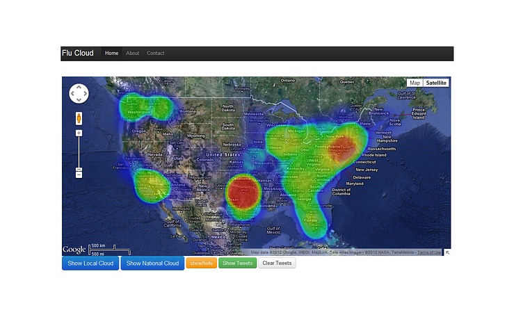
Flu Cloud
We introduced the concept of "Flu Cloud" which presented a spatial visualization of the Influenza-Like Illness (ILI) based on the results of density-based clustering. The proposed Flu Cloud is like the weather map produced by satellites in weather forecasting: it maps the flu related tweets with coordinates into density based clusters for the general population. Public available tweets streaming provides the possibility of updating the Flu Cloud in near real time. In the long term, detecting the movement of the Flu Cloud over time helps the understanding and prediction of the dynamic trends of Influenza in high-resolution.
More by Nord Tech Creative View profile
Like
