Disneyland Resort transit-style map
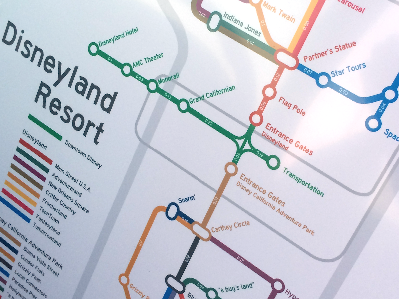


This was a personal project where I wanted to express the connections between different attractions and places in the Disneyland Resort. I notated surrounding vehicular geography (and the Monorail for kicks and giggles). Finally, I used the map editor at alltrails.com to determine the walking distance between each attraction and added that to the map.
It's tounge-in-cheek — obviously you don't need to know which "stop" to get off at when you're walking around — but a fun project nonetheless.
Thanks to http://www.cambooth.net/archives/722 for the help!
