Prism360 Map


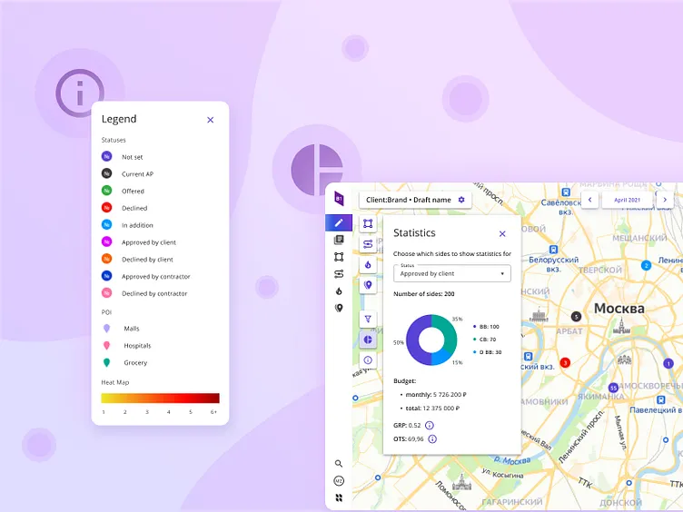
🇬🇧 The main function of the map is to show constructions on the ground. On a small scale, constructions sides are combined into clusters - circles, the border of which shows the status of constructions inside.
For each side, you can view the details, set its status, leave a comment or go to the side editor.
Statistics, legend and other functions are hidden behind small buttons that do not interfere with viewing the main area - the map.
🇷🇺 Функция карты сторон — показ конструкций на местности. В мелком масштабе стороны конструкций объединяются в кластеры — круги, обводка которых показывает статусы конструкций внутри.
По каждой стороне можно посмотреть детали, задать ее статус, оставить комментарий или перейти в редактор стороны.
Статистика, легенда и другие функции скрыты за небольшими кнопками, которые не мешают просмотру основной области — карты.
