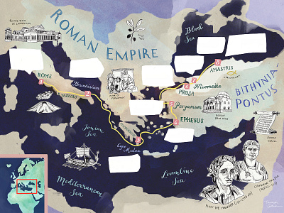
Roman Empire Map Illustration for BBC World Histories Magazine
For Issue IX of BBC World Histories magazine I have illustrated a map of the Mediterranean Sea during the Roman Empire / Antiquity. The map follows the travel route of Roman writer Pliny the Younger, who set out to the Eastern corners of the Roman Empire, Bithynia-Pontus (modern day Turkey) in 111 AD.
More by Theresa Grieben View profile
Like
