Urban planning (with 3D mapping applications)


We - The Flexatel team - work extensively with 3D mapping applications and has completed several projects related to urban planning and analysis of development for various types of territories.
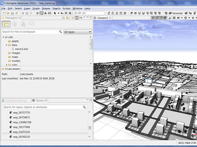
A recent example is a 2019/2020 project that used City Engine to develop a web scene capable of instantly changing 3D models and calculating prices of all district projects in urban, suburban, and rural placement:
• Interactive project in CityEngine
• Option to export results to Database using Python
• Dynamic algorithms for calculating prices of the entire 3D scene
• Graphical user interface for managing scene and option to instant change 3D models
• Custom CGA rules
• Export project as a web scene
• Configuration of general parameters of the route network and vehicles
• Connection with a database
• CGA and Python algorithms
