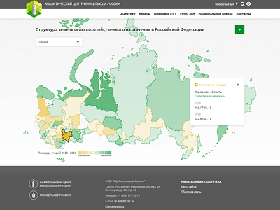
Geoportal For Analytical Center Of The Ministry of Agriculture
Geoportal For Analytical Center Of The Ministry of Agriculture.
The portal, created for the ministry’s analytical center, is a tool that allows users to work with cartographic information, plans, and data with reference to specific areas based on intended use, and to visualize relevant digital parameters. The analytical portal aggregates all available industry information, including data on land use with maximum detail. Department leadership is then able to generate reports on the dynamic of selected variables, comparison of territories, and efficiency of use, among other data.
The project included:
⁃ updating portal design regularly
⁃ developing new layouts to facilitate portal use, with cartographic application design in mind
⁃ implementing updated design within key portal areas
⁃ digitizing maps for several Russian regions, with land areas differentiated by intended use
⁃ creating a home page
⁃ developing and launching an interactive version to demonstrate portal features
