Philadelphia Land Use Map
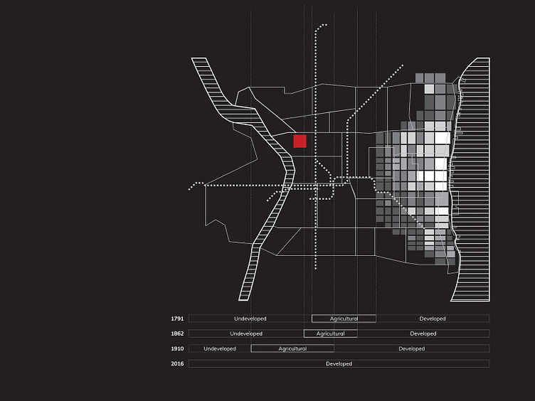
Loved working on this map of Philadelphia for an urban planning project—it overlays contemporary neighborhoods and transit lines on top of block density data showing the east-to-west expansion of the city since the 1700s
Loved working on this map of Philadelphia for an urban planning project—it overlays contemporary neighborhoods and transit lines on top of block density data showing the east-to-west expansion of the city since the 1700s
