Disability Access for Google Maps
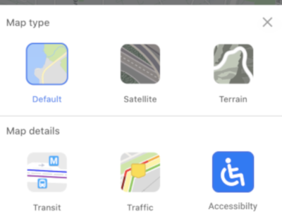
I made these designs for a mobile app for the WINFO 2020 Protothon earlier this year. Our design challenge was to create something to make the world more accessible as part of the UW Information School's goal. We decided to create a design for a google maps addition for disability access. Currently there's a web application seperate from Google maps and other maps applications for people with disabilities to use to navigate some areas of the U.S. But this map is limited by the amount of data they can collect through a population and it's othering of people with varying abilities. Without integrating people into our applications, we're saying they don't need to be accounted for. Which is why we decided to create a Google maps addition instead of designing our own application. We made it so people can report changes to their route, choose what kind of ability they have, and view the inclines of certain areas (which is super helpful in Seattle as we're a mountain city). I really enjoyed attending the protothon and creating this design with a bunch of cool women in tech at my university.


